Expedition Santi Find The Eagle 2019 – Report
From 31st July to 8th August 2019, we managed to accomplish another expedition searching the ORP ‘Eagle” wreck in the North Sea within the”SANTI Odnalezc Orla” project. Loading and transport of the necessary equipment was carried out without any major problems. Early, on 29 July, in the morning we started the first stage by moving from Gdynia to Denmark. We started the expedition in the port of Thyboron, and for searching we used the same ship as the year before – NEMO ‘A’. The installation and launching of equipment went smoothly, mainly thanks to our specialists from the Maritime Institute in Gdansk. The composition of the crew changed slightly during the year, although the new members of the crew, as it turned out later, surprised us with their determination and professionalism. This year in our team included: Tomasz Stachura, head of the expedition, Benedykt Hac, head of the hydrographic team, two hydrographs Pawel Wysocki and Karol Jacob, Piotr Michalik responsible for historical support in the UK and two divers Lukasz Piorewicz and Marek Cacaj.
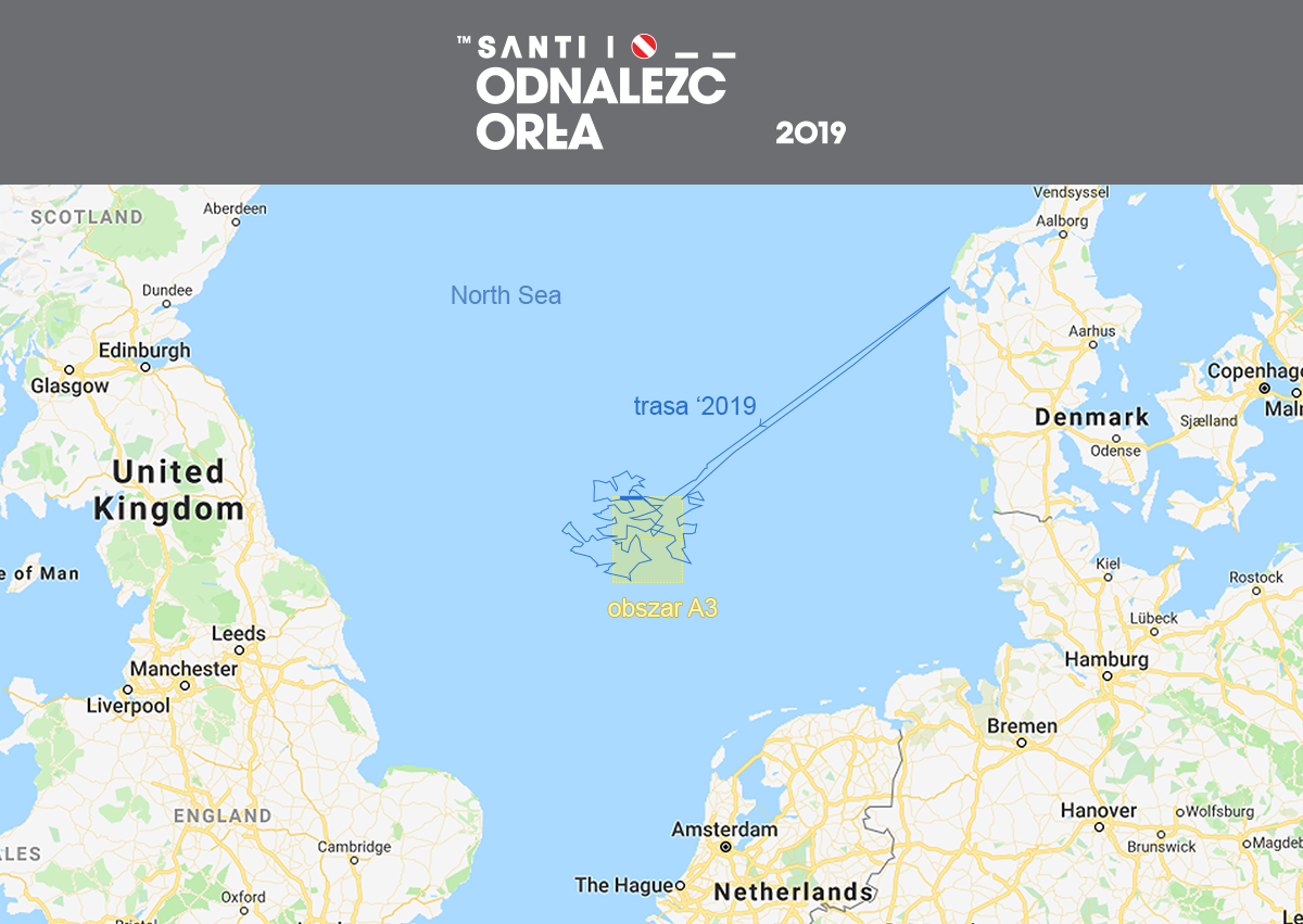
The assumptions and plans of this year’s expedition were slightly different from previous ones. So far we have focused on verifying so-called “Friendly Fire” hypothesis, according to which, the Eagle could have been accidentally sunk by the English. We have already searched 4 times the area connected with this hypothesis. This time we decided to focus on new actions. For this year’s expedtion we chose the area “A3”, which is connected with the hypothesis that ORP “Eagle” could sink in its first days after the departure. This is supported by the fact that ‘Eagle” did not contact the base in Rosyth even once during the whole last patrol. There are two hypotheses behind this, either ‘Eagle’ had a broken radio station, which made contact impossible, or ‘Eagle’ was sunk at the beginning of the patrol. Thanks to the numerous hours of preparation, verification of hundreds pages in the archives, conversations with local fishermen, we had prepared positions that we were going to verify.
In the first days of the trip the weather was favorable. Seasoned in battle, motivated and tenacious, we proceeded to act and check our positions. To explore the seabed we used an advanced multi-beam SeaBat 7125, thanks to the support of GeoFusion company. We checked about 200m of seabed, with each meter we’ve been creating a three-dimensional map. When wrecks appeared on the screens, not only we were able to determine what kind of vessel, cutter, merchant ship or warship it is, but also the dimensions of the wreck with an accuracy of 0.5m.
In total we crossed 984 NM (1824km). We managed to check 183 positions, 83 of them were wrecks. In the case of 14 positions, the sonar indicated anomalies, which in the end could have been the remains of pipes, stones or naturally shaped hills. We worked day and night, the equipment worked practically without rest, just like we did. Some of the verified positions came from local fishermen who, in order to support us, shared maps and knowledge gained for generations. Some of the positions we gained were never confirmed, so we wanted to verify everything to make sure we didn’t miss our “Eagle” anywhere.
The weather conditions changed on the seventh day of the expedition, huge waves were throwing the unit and the researches were very difficult. The equipment was on the verge of being able to scan the seabed. In order to complete our plan, we worked constantly. On the eighth day we decided to end the expedition and return. Traditionally, in order to commemorate our heroes and all those who died at sea, we put a wreath.
We do not give up, we are full of enthusiasm. After a moment of rest, return home, we will be ready to act. Further we know that the “Eagle” is waiting for us….
At this point, we would like to express our special thanks to all those who support us. Unusual words of encouragement increase our motivation. Many thanks to our partners: Maritime Institute in Gdansk for providing equipment and Yellow Cargo for logistic support. We would also like to thank our sponsors, SANTI for the long-term support of our project, DAMEN for the financial support and GeoFusion.


